Agentic AI for mineral exploration
Joint probabilistic geophysical inversion + 13-agent AI workflow. Two-person team. Built in six weeks. Validated on real public data — Mountain Pass (REE), Bushveld (PGE), and Harrat Rahat (Saudi Arabia).
Real-data proof, not synthetics
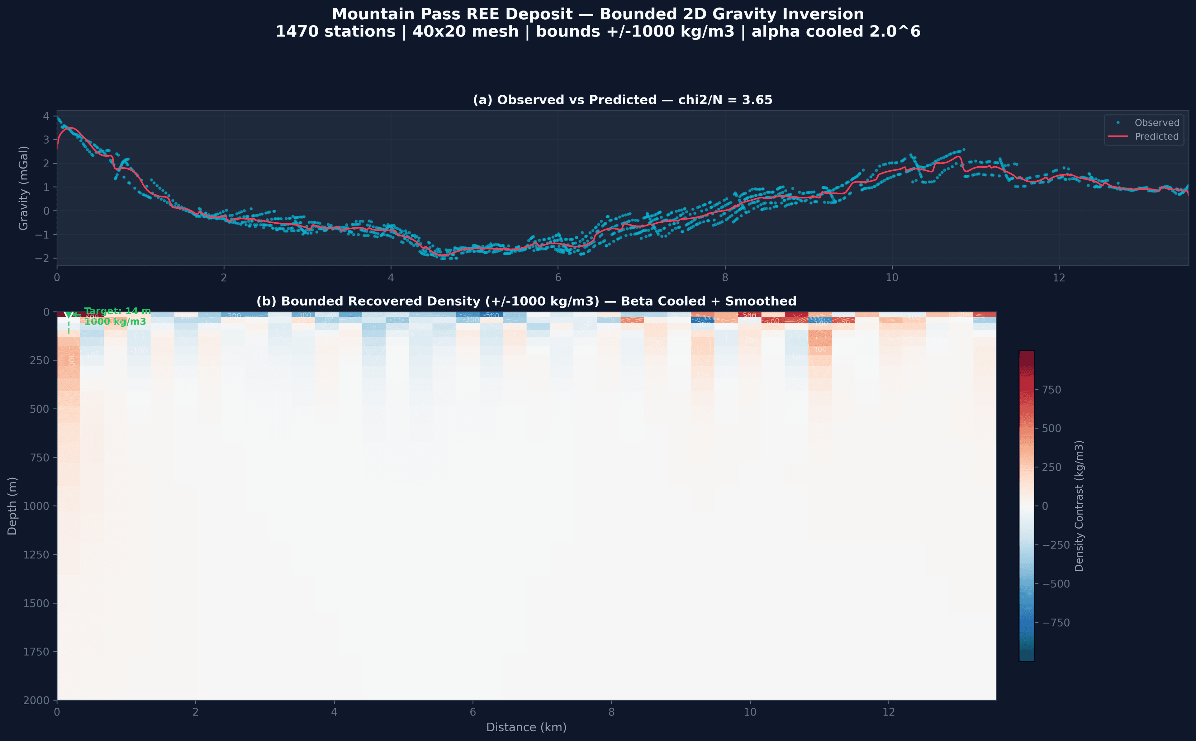
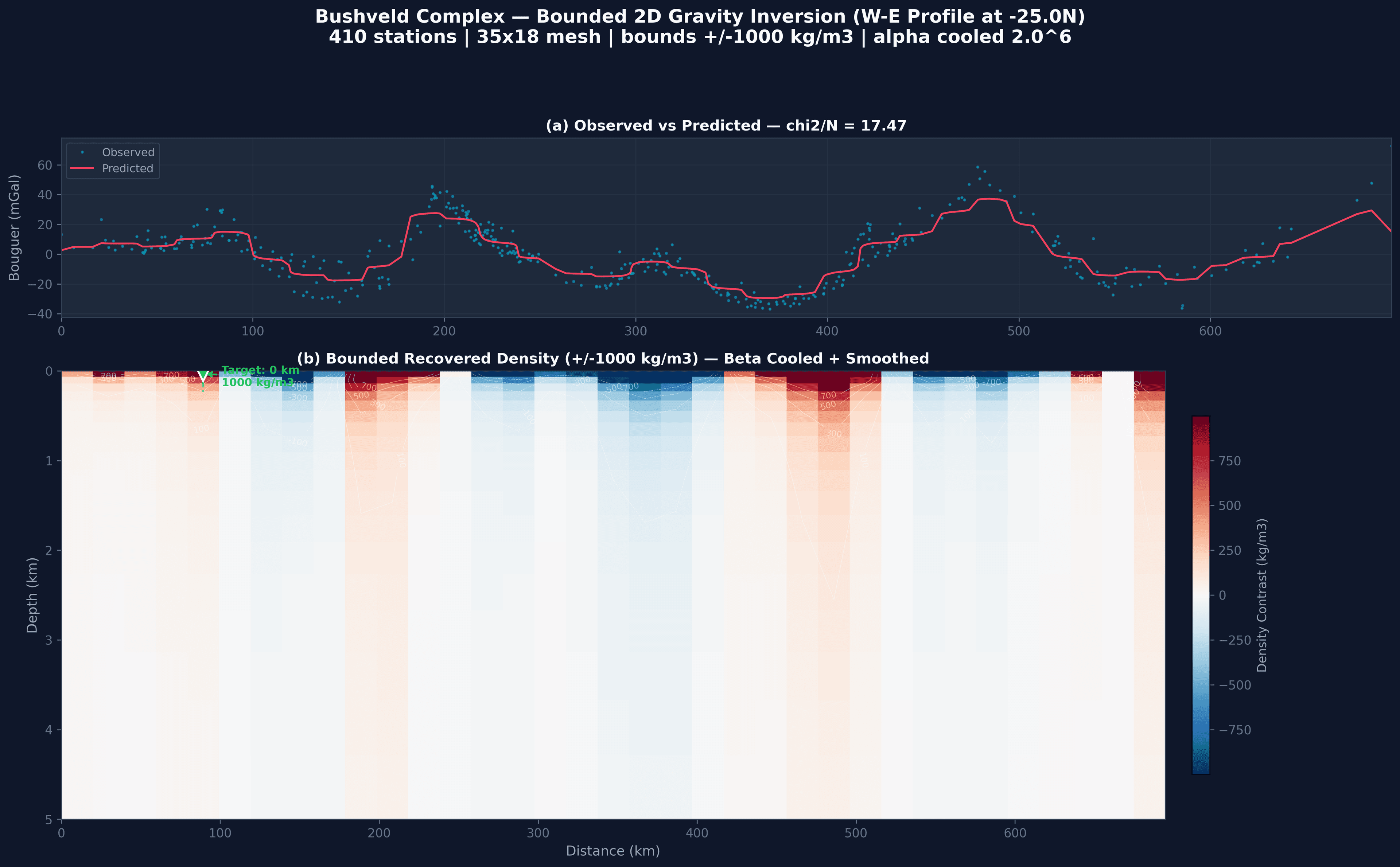
Most geophysics demos use synthetic data because real surveys break academic methods. We ran our bounded joint inversion on public gravity gradiometry from Mountain Pass (537,000 stations) and Bouguer gravity from Bushveld (3,877 stations). Cross-sections recover the known ore geometry.
1,470-station E-W profile · 40×20 mesh · 25m surface cells · alpha cooled 2⁶ → 1 · ±1000 kg/m³ bounds
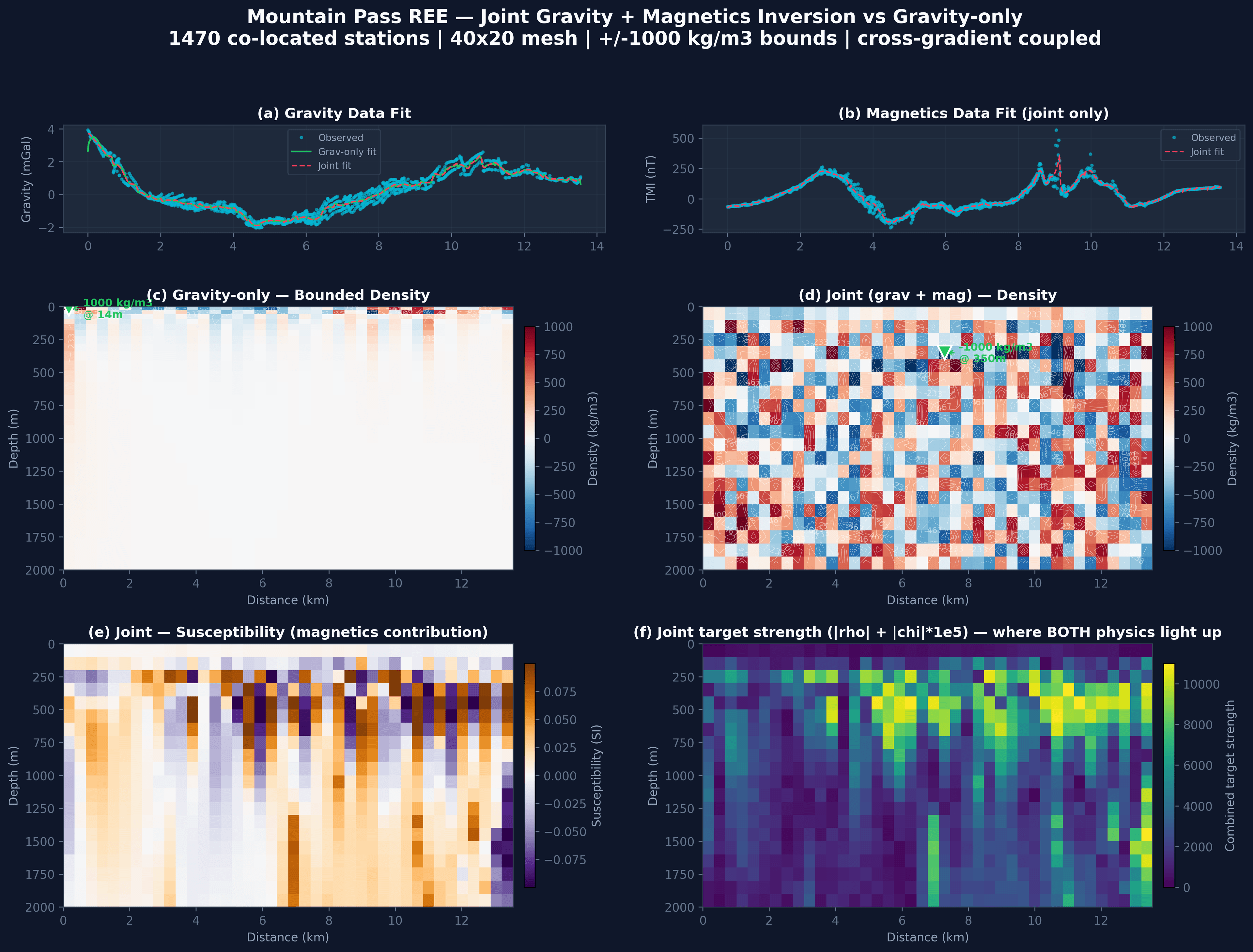
1,470 co-located stations · cross-gradient coupled · bounded density + susceptibility · 40–49% uncertainty reduction vs. gravity-only
410-station W-E profile · 680 km extent · 35×18 mesh · PGE reef target · same bounded algorithm
Traction
Why this is hard to replicate
Team
Strategic context
For acquirers evaluating mining-software assets, three natural fits: